Talaksan:Gulf of Tonkin.jpg
Laki ng pasilip na ito: 800 x 428 na pixel. Ibang mga resolusyon: 320 x 171 na pixel | 640 x 342 na pixel | 1,024 x 548 na pixel | 1,280 x 685 na pixel | 2,560 x 1,370 na pixel | 5,912 x 3,163 na pixel.
Buong resolusyon ((5,912 × 3,163 pixel, laki ng talaksan: 2.53 MB, uri ng MIME: image/jpeg))
|
|
Ito ay isang talaksan mula sa Wikimedia Commons. Makikita sa ibaba ang impormasyon mula sa pahina ng paglalarawan nito roon. |
Buod
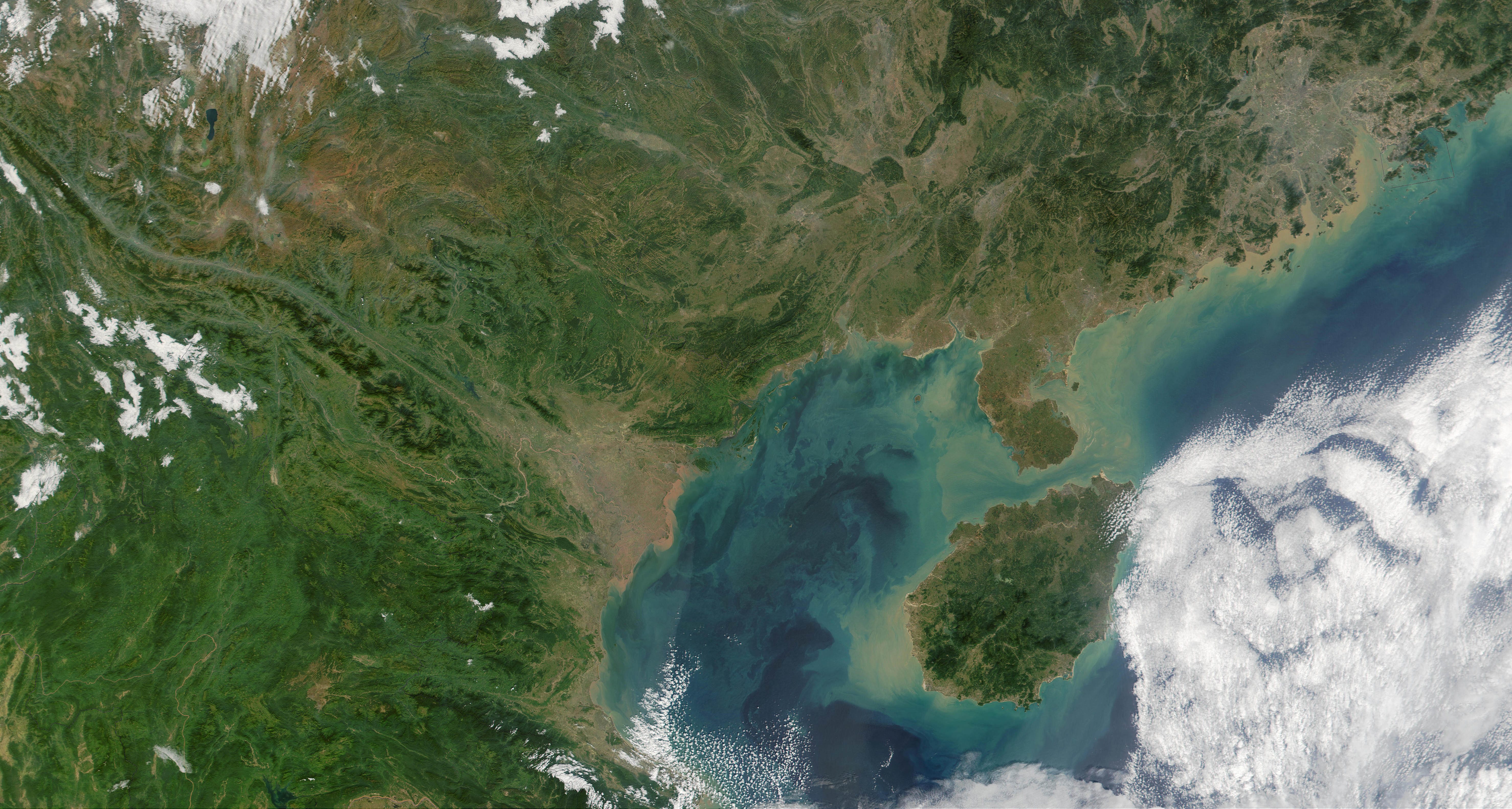
| Paglalarawan | Satelite image of Gulf of Tonkin. |
| Petsa | |
| Pinanggalingan | NASA Visible Earth. cropped from http://visibleearth.nasa.gov/view_rec.php?id=2301 |
| May-akda | NASA |
| Iba pang mga bersyon |
.jpg)
Paglilisensiya
| This file is in the public domain in the United States because it was solely created by NASA. NASA copyright policy states that "NASA material is not protected by copyright unless noted". (See Template:PD-USGov, NASA copyright policy page or JPL Image Use Policy.) | ||
 |
Warnings:
|
Nakaraan ng file
Pindutin ang araw/oras upang makita kung papaano ang itsura ng talaksan noong oras na iyon.
| Araw/Oras | Thumbnail | Mga dimensiyon | tagagamit | Kumento | |
|---|---|---|---|---|---|
| ngayon | 15:47, 22 Hunyo 2013 | | 5,912 × 3,163 (2.53 MB) | Earth100 | Higher resolution, KOREAN! |
| 11:10, 25 Agosto 2007 |  | 706 × 602 (175 KB) | ChongDae | {{Information |Description=Satelite image of Leizhou Peninsula. |Source=NASA Visible Earth. cropped from http://visibleearth.nasa.gov/view_rec.php?id=2301 |Date=2001-11-16 |Author=NASA |Permission= |other_versions= }} == Licensi |
Mga ugnay
Nakaturo sa talaksan na ito ang mga sumusunod na mga pahina:
Pandaigdigang paggamit sa file
Ginagamit ng mga sumusunod na wiki ang file na ito:
- Paggamit sa af.wikipedia.org
- Paggamit sa az.wikipedia.org
- Paggamit sa be.wikipedia.org
- Paggamit sa bg.wikipedia.org
- Paggamit sa bn.wikipedia.org
- Paggamit sa br.wikipedia.org
- Paggamit sa ca.wikipedia.org
- Paggamit sa cy.wikipedia.org
- Paggamit sa de.wiktionary.org
- Paggamit sa el.wikipedia.org
- Paggamit sa en.wikipedia.org
- Paggamit sa eo.wikipedia.org
- Paggamit sa es.wikipedia.org
- Paggamit sa et.wikipedia.org
- Paggamit sa eu.wikipedia.org
- Paggamit sa fi.wikipedia.org
- Paggamit sa fr.wikipedia.org
- Paggamit sa he.wikipedia.org
- Paggamit sa hy.wikipedia.org
- Paggamit sa ilo.wikipedia.org
- Paggamit sa it.wikipedia.org
- Paggamit sa ja.wikipedia.org
- Paggamit sa km.wikipedia.org
- Paggamit sa ko.wikipedia.org
- Paggamit sa lt.wikipedia.org
- Paggamit sa mzn.wikipedia.org
- Paggamit sa nl.wikipedia.org
- Paggamit sa nn.wikipedia.org
- Paggamit sa no.wikipedia.org
- Paggamit sa pl.wikipedia.org
- Paggamit sa pl.wiktionary.org
- Paggamit sa pt.wikipedia.org
- Paggamit sa sl.wikipedia.org
- Paggamit sa sr.wikipedia.org
- Paggamit sa sv.wikipedia.org
- Paggamit sa uk.wikipedia.org
- Paggamit sa vi.wikipedia.org
- Paggamit sa www.wikidata.org
- Paggamit sa zh-yue.wikipedia.org
- Paggamit sa zh.wikipedia.org