Talaksan:Socotra satview.jpg
Laki ng pasilip na ito: 800 x 593 na pixel. Ibang mga resolusyon: 320 x 237 na pixel | 640 x 474 na pixel | 1,024 x 758 na pixel | 1,280 x 948 na pixel.
Buong resolusyon ((1,280 × 948 pixel, laki ng talaksan: 159 KB, uri ng MIME: image/jpeg))
|
|
Ito ay isang talaksan mula sa Wikimedia Commons. Makikita sa ibaba ang impormasyon mula sa pahina ng paglalarawan nito roon. |
Buod
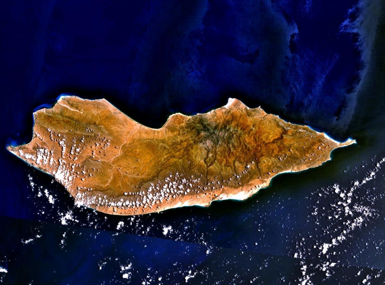
Satellite image over Socotra Island (سُقُطْرَى ; Suquṭra), made using NASA World Wind using Landsat imagery.
Paglilisensiya
| This image is in the public domain because it is a screenshot from NASA’s globe software World Wind using a public domain layer, such as Blue Marble, MODIS, Landsat, SRTM, USGS or GLOBE.
|
 |
Tala ng orihinal na pagkarga
All following user names refer to en.wikipedia.
- 2005-07-15 18:16 Finlay McWalter 1280×948×8 (163257 bytes) Satellite image of [[Socotra]], made using [[NASA World Wind]] using [[Landsat]] imagery. {{PD-USGov-NASA}}
| Annotations | This image is annotated: View the annotations at Commons |
Nakaraan ng file
Pindutin ang araw/oras upang makita kung papaano ang itsura ng talaksan noong oras na iyon.
| Araw/Oras | Thumbnail | Mga dimensiyon | tagagamit | Kumento | |
|---|---|---|---|---|---|
| ngayon | 16:16, 7 Enero 2007 | | 1,280 × 948 (159 KB) | EskoG-67 | {{Information |Description= Satellite image over Socotra island |Source=NASA Landsat |Date= 7.1.2007 |Author= |Permission= |other_versions= }} |
Mga ugnay
Nakaturo sa talaksan na ito ang mga sumusunod na mga pahina:
Pandaigdigang paggamit sa file
Ginagamit ng mga sumusunod na wiki ang file na ito:
- Paggamit sa af.wikipedia.org
- Paggamit sa ar.wikipedia.org
- Paggamit sa ast.wikipedia.org
- Paggamit sa az.wikipedia.org
- Paggamit sa be-tarask.wikipedia.org
- Paggamit sa be.wikipedia.org
- Paggamit sa bg.wikipedia.org
- Paggamit sa bn.wikipedia.org
- Paggamit sa ca.wikipedia.org
- Paggamit sa cs.wikipedia.org
- Paggamit sa cv.wikipedia.org
- Paggamit sa cy.wikipedia.org
- Paggamit sa da.wikipedia.org
- Paggamit sa de.wikipedia.org
- Paggamit sa diq.wikipedia.org
- Paggamit sa el.wikipedia.org
- Paggamit sa en.wikipedia.org
- Paggamit sa eo.wikipedia.org
- Paggamit sa es.wikipedia.org
- Paggamit sa et.wikipedia.org
- Paggamit sa eu.wikipedia.org
- Paggamit sa fa.wikipedia.org
- Paggamit sa fi.wikipedia.org
- Paggamit sa fr.wikipedia.org
Tingnan ang karagdagang pandaigdigang paggamit sa file na ito.