Talaksan:Asylum Township.jpg
Laki ng pasilip na ito: 800 x 494 na pixel. Ibang mga resolusyon: 320 x 197 na pixel | 640 x 395 na pixel | 1,024 x 632 na pixel | 1,280 x 790 na pixel | 2,560 x 1,579 na pixel | 3,717 x 2,293 na pixel.
Buong resolusyon ((3,717 × 2,293 pixel, laki ng talaksan: 6.88 MB, uri ng MIME: image/jpeg))
|
|
Ito ay isang talaksan mula sa Wikimedia Commons. Makikita sa ibaba ang impormasyon mula sa pahina ng paglalarawan nito roon. |
| Paglalarawan |
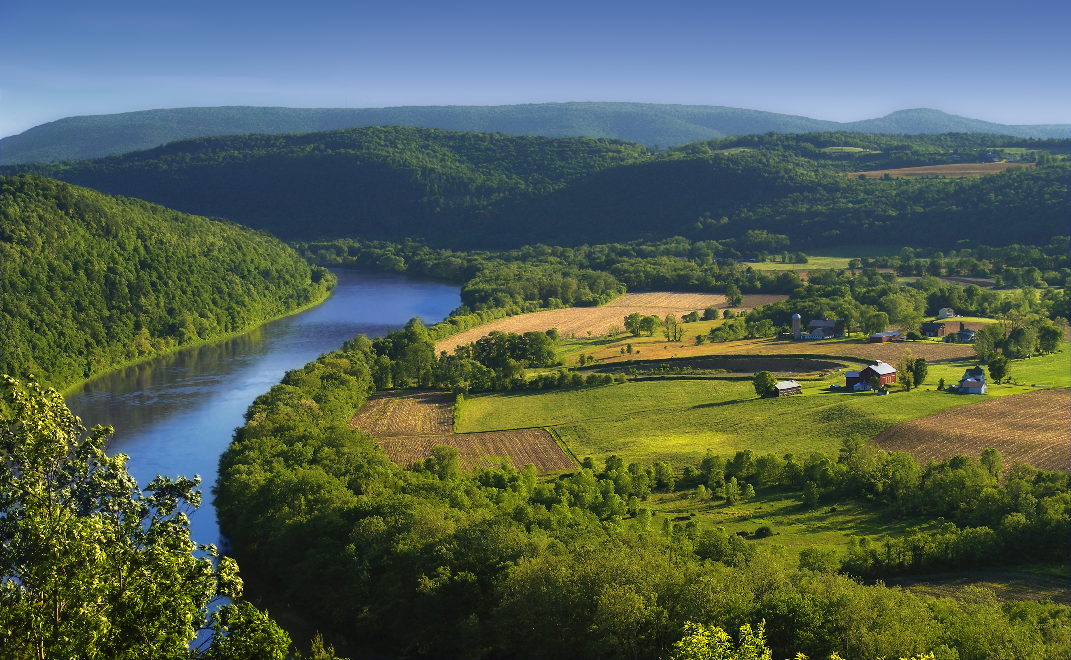
English: The Susquehanna River, Asylum Township, Bradford County, as seen from the Marie Antoinette Lookout off of US Route 6 near Wyalusing in Pennsylvania. Visible from here is the French Azilum Historic Site, where some Revolution-fleeing French aristocrats settled in 1793. It was said that Marie Antoinette planned to settle in a house across the river from the lookout which was allegedly built for her. The marker reads: A settlement of French royalists, who fled the French Revolution in 1793, was established in the valley directly opposite this marker. It was laid out and settled under the direction of Viscount de Noailles and Marquis Antoine Omer Talon. It was hoped that Queen Marie Antoinette might here find safety. Marie Antoinette Lookout, Route 6, Wyalusing, PA. |
||
| Petsa | |||
| Pinanggalingan | https://www.flickr.com/photos/nicholas_t/3594274494/ | ||
| May-akda | Nicholas A. Tonelli from Northeast Pennsylvania, USA | ||
| Permiso (Muling paggamit sa file) |
|
| Camera location | | View this and other nearby images on: OpenStreetMap |
|---|
Paglilisensiya
Ang talaksang ito ay nakalisensiya sa ilalim ng lisensiyang Atribusyon 2.0 Heneriko ng Creative Commons.
- Malaya kang:
- para ibahagi – para kopyahin, ipamahagi, at i-transmit ang akda
- para i-remix – para i-adapt ang akda
- Sa ilalim ng mga kondisyong ito:
- atribusyon – Dapat magbigay ka ng isang maayos na pag-credit, ibigay ang link sa lisensiya, at tukuyin kung may mga pagbabagong ginawa. Magagawa mo ito sa isang risonableng paraan, pero hindi sa paraan na para bang ineendorso ka o ng paggamit mo ng naglisensiya sa'yo.
Nakaraan ng file
Pindutin ang araw/oras upang makita kung papaano ang itsura ng talaksan noong oras na iyon.
| Araw/Oras | Thumbnail | Mga dimensiyon | tagagamit | Kumento | |
|---|---|---|---|---|---|
| ngayon | 00:49, 6 Hunyo 2009 | | 3,717 × 2,293 (6.88 MB) | Flickr upload bot | Uploaded from http://flickr.com/photo/14922165@N00/3594274494 using Flickr upload bot |
Mga ugnay
Nakaturo sa talaksan na ito ang mga sumusunod na mga pahina:
Pandaigdigang paggamit sa file
Ginagamit ng mga sumusunod na wiki ang file na ito:
- Paggamit sa ar.wikipedia.org
- Paggamit sa azb.wikipedia.org
- Paggamit sa cy.wikipedia.org
- Paggamit sa da.wikipedia.org
- Paggamit sa en.wikipedia.org
- Paggamit sa eo.wikipedia.org
- Paggamit sa es.wikipedia.org
- Paggamit sa fi.wikipedia.org
- Paggamit sa fr.wikipedia.org
- Paggamit sa fy.wikipedia.org
- Paggamit sa hu.wikipedia.org
- Paggamit sa id.wikipedia.org
- Paggamit sa it.wikipedia.org
- Paggamit sa ko.wikipedia.org
- Paggamit sa ml.wikipedia.org
- Paggamit sa ms.wikipedia.org
- Paggamit sa new.wikipedia.org
- Paggamit sa sl.wikipedia.org
- Paggamit sa sr.wikipedia.org
- Paggamit sa sv.wikipedia.org
- Paggamit sa th.wikipedia.org
- Paggamit sa tr.wikipedia.org
- Paggamit sa uk.wikipedia.org
- Paggamit sa vi.wikipedia.org
- Paggamit sa www.wikidata.org
- Paggamit sa xmf.wikipedia.org
- Paggamit sa zh.wikipedia.org