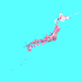
Talaksan:Cities in Japan.png

Laki ng pasilip na ito: 600 x 600 na pixel. Ibang mga resolusyon: 240 x 240 na pixel | 480 x 480 na pixel | 768 x 768 na pixel | 1,024 x 1,024 na pixel | 2,048 x 2,048 na pixel | 5,310 x 5,310 na pixel.
Buong resolusyon ((5,310 × 5,310 pixel, laki ng talaksan: 883 KB, uri ng MIME: image/png))
Nakaraan ng file
Pindutin ang araw/oras upang makita kung papaano ang itsura ng talaksan noong oras na iyon.
| Araw/Oras | Thumbnail | Mga dimensiyon | tagagamit | Kumento | |
|---|---|---|---|---|---|
| ngayon | 17:14, 1 Abril 2021 |  | 5,310 × 5,310 (883 KB) | そらみみ | update |
| 06:29, 2 Hunyo 2020 |  | 5,310 × 5,310 (883 KB) | そらみみ | Update. | |
| 08:42, 18 Abril 2019 |  | 5,310 × 5,310 (883 KB) | そらみみ | Update. | |
| 18:53, 3 Oktubre 2018 |  | 5,310 × 5,310 (883 KB) | そらみみ | Updating. | |
| 06:09, 2 Abril 2018 |  | 5,310 × 5,310 (883 KB) | そらみみ | Updating. | |
| 11:04, 1 Enero 2017 |  | 5,310 × 5,310 (883 KB) | そらみみ | 八戸市 | |
| 16:20, 22 Disyembre 2016 |  | 5,310 × 5,310 (883 KB) | そらみみ | Adjusting. | |
| 19:01, 13 Disyembre 2016 |  | 5,310 × 5,310 (883 KB) | そらみみ | Adjusting color. | |
| 18:40, 13 Disyembre 2016 |  | 5,310 × 5,310 (883 KB) | そらみみ | Correcting and updating. | |
| 21:13, 18 Agosto 2015 |  | 5,310 × 5,310 (362 KB) | ASDFGH | {{Information |Description=Map of all Japanese cities including disputed territories |Source= File:Japan Municipality Map.png |Date= 2015-06-15 |Author= ASDFGH |Permission={{GFDL}} {{Convert to SVG}} |other_versions= }} [[Category... |
Mga ugnay
Nakaturo sa talaksan na ito ang mga sumusunod na mga pahina:
Pandaigdigang paggamit sa file
Ginagamit ng mga sumusunod na wiki ang file na ito:
- Paggamit sa ar.wikipedia.org
- Paggamit sa en.wikipedia.org
- Paggamit sa fi.wikipedia.org
- Paggamit sa hy.wikipedia.org
- Paggamit sa id.wikipedia.org
- Paggamit sa ilo.wikipedia.org
- Paggamit sa it.wikipedia.org
- Paggamit sa ja.wikipedia.org
- Paggamit sa ko.wikipedia.org
- Paggamit sa ms.wikipedia.org
- Paggamit sa ru.wikipedia.org
- Paggamit sa si.wikipedia.org
- Paggamit sa th.wikipedia.org
- Paggamit sa tr.wikipedia.org
- Paggamit sa uz.wikipedia.org
- Paggamit sa zh.wikipedia.org


