Talaksan:Haiti OnEarth WMS.jpg

Laki ng pasilip na ito: 788 x 600 na pixel. Ibang mga resolusyon: 315 x 240 na pixel | 631 x 480 na pixel | 1,009 x 768 na pixel | 1,280 x 974 na pixel | 2,560 x 1,949 na pixel | 3,719 x 2,831 na pixel.
Buong resolusyon ((3,719 × 2,831 pixel, laki ng talaksan: 5.1 MB, uri ng MIME: image/jpeg))
|
|
Ito ay isang talaksan mula sa Wikimedia Commons. Makikita sa ibaba ang impormasyon mula sa pahina ng paglalarawan nito roon. |
Buod
| Paglalarawan |
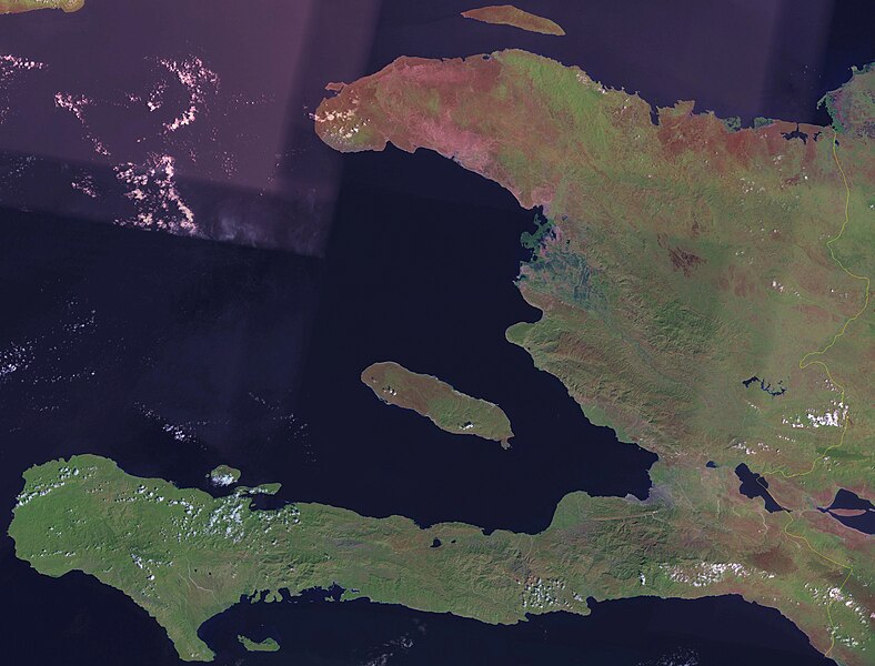
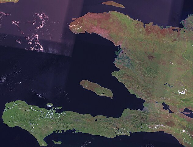
English: Satellite image of Haiti. |
| Petsa | circa 2006 |
| Pinanggalingan | Screenshot from NASA World Wind, OnEarth WMS global mosaic pseudocolor layer. |
| May-akda | NASA |
Paglilisensiya
| This image is in the public domain because it is a screenshot from NASA’s globe software World Wind using a public domain layer, such as Blue Marble, MODIS, Landsat, SRTM, USGS or GLOBE.
|
 |
Nakaraan ng file
Pindutin ang araw/oras upang makita kung papaano ang itsura ng talaksan noong oras na iyon.
| Araw/Oras | Thumbnail | Mga dimensiyon | tagagamit | Kumento | |
|---|---|---|---|---|---|
| ngayon | 18:40, 21 Abril 2006 | | 3,719 × 2,831 (5.1 MB) | Hautala | {{PD-WorldWind}} Satellite image of Haiti. Screenshot from NASA World Wind, OnEarth WMS layer. Category:Satellite images of countries |
Mga ugnay
Nakaturo sa talaksan na ito ang mga sumusunod na mga pahina:
Pandaigdigang paggamit sa file
Ginagamit ng mga sumusunod na wiki ang file na ito:
- Paggamit sa af.wikipedia.org
- Paggamit sa en.wikipedia.org
- Paggamit sa fi.wikipedia.org
- Paggamit sa pl.wikipedia.org
- Paggamit sa uk.wikipedia.org