Talaksan:Japan Relief Map of Land and Seabed.png
Laki ng pasilip na ito: 727 x 599 na pixel. Ibang resolusyon: 291 x 240 na pixel | 582 x 480 na pixel | 932 x 768 na pixel | 1,242 x 1,024 na pixel | 2,117 x 1,745 na pixel.
Buong resolusyon ((2,117 × 1,745 pixel, laki ng talaksan: 7.47 MB, uri ng MIME: image/png))
|
|
Ito ay isang talaksan mula sa Wikimedia Commons. Makikita sa ibaba ang impormasyon mula sa pahina ng paglalarawan nito roon. |
Buod
| Paglalarawan |
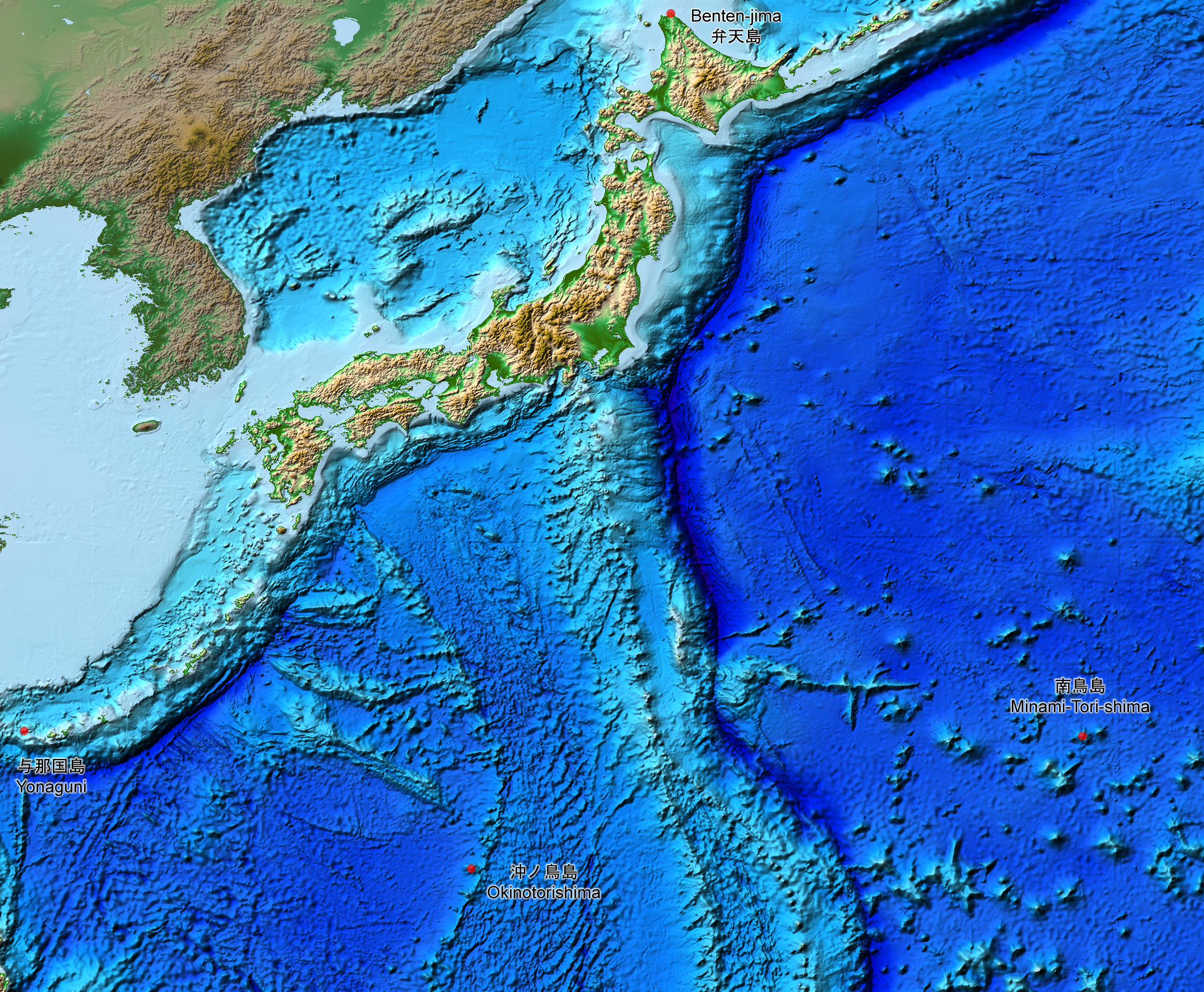
English: This is a relief map of the land and the seabed of Japan. It shows the surface and underwater terrain of the Japanese archipelago. It includes all the Japanese islands such as Minami-Tori-Shima, Benten-jima, Okinotorishima and Yonaguni.
日本語: 日本近海海底地形図と日本列島。 |
| Petsa | |
| Pinanggalingan | ETOPO1, Global Relief Model, https://www.ngdc.noaa.gov/mgg/global/global.html |
| May-akda | NASA, National Geophysical Data Center, NOAA |
Paglilisensiya
| This file is in the public domain in the United States because it was solely created by NASA. NASA copyright policy states that "NASA material is not protected by copyright unless noted". (See Template:PD-USGov, NASA copyright policy page or JPL Image Use Policy.) | ||
 |
Warnings:
|
Nakaraan ng file
Pindutin ang araw/oras upang makita kung papaano ang itsura ng talaksan noong oras na iyon.
| Araw/Oras | Thumbnail | Mga dimensiyon | tagagamit | Kumento | |
|---|---|---|---|---|---|
| ngayon | 15:07, 5 Agosto 2019 | | 2,117 × 1,745 (7.47 MB) | Artanisen | The continent geography is darker to highlight the Japanese archipelago. |
| 06:29, 22 Hulyo 2019 |  | 2,117 × 1,745 (7.54 MB) | Artanisen | User created page with UploadWizard |
Mga ugnay
Nakaturo sa talaksan na ito ang mga sumusunod na mga pahina:
Pandaigdigang paggamit sa file
Ginagamit ng mga sumusunod na wiki ang file na ito:
- Paggamit sa ar.wikipedia.org
- Paggamit sa ast.wikipedia.org
- Paggamit sa be.wikipedia.org
- Paggamit sa ca.wikipedia.org
- Paggamit sa de.wikipedia.org
- Paggamit sa en.wikipedia.org
- Paggamit sa es.wikipedia.org
- Paggamit sa fr.wikipedia.org
- Paggamit sa id.wikipedia.org
- Paggamit sa it.wikipedia.org
- Paggamit sa ja.wikipedia.org
- Paggamit sa min.wikipedia.org
- Paggamit sa pnb.wikipedia.org
- Paggamit sa pt.wikipedia.org
- Paggamit sa ru.wikipedia.org
- Paggamit sa sl.wikipedia.org
- Paggamit sa sr.wikipedia.org
- Paggamit sa uk.wikipedia.org
- Paggamit sa vi.wikipedia.org
- Paggamit sa www.wikidata.org
- Paggamit sa zh-min-nan.wikipedia.org
- Paggamit sa zh.wikipedia.org