Talaksan:Northern Ireland counties + districts.png

Laki ng pasilip na ito: 746 x 599 na pixel. Ibang resolusyon: 299 x 240 na pixel | 598 x 480 na pixel | 956 x 768 na pixel | 1,275 x 1,024 na pixel | 1,672 x 1,343 na pixel.
Buong resolusyon ((1,672 × 1,343 pixel, laki ng talaksan: 441 KB, uri ng MIME: image/png))
|
|
Ito ay isang talaksan mula sa Wikimedia Commons. Makikita sa ibaba ang impormasyon mula sa pahina ng paglalarawan nito roon. |
Buod
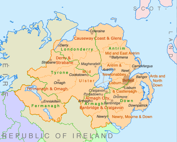
| Paglalarawan | Counties and disticts of Northern Ireland |
| Petsa | |
| Pinanggalingan | File:Counties of Ireland.svg & File:United Kingdom Northern Ireland adm location map.svg |
| May-akda | Ulamm (usapan) |
Paglilisensiya
Ako, na may karapatang-ari ng akdang ito, ang naglalathala nito alinsunod sa ilalim ng sumusunod na mga lisensya:

|
Pinapayagan ang pagkopya, pamamahagi, at/o pagbabago sa dokumentong ito sa ilalim ng mga nakasaad sa GNU Free Documentation License, Bersyon 1.2 o kahit anong mas bagong bersyong nilathala ng Free Software Foundation; nang walang pabago-bagong bahagi, walang teksto sa front-cover, at walang teksto sa back-cover. May nakalagay na kopya ng lisensiya sa bahaging pinamagatang GNU Free Documentation License. |
This file is licensed under the Creative Commons Attribution-Share Alike 4.0 International, 3.0 Unported, 2.5 Generic, 2.0 Generic and 1.0 Generic license.
- Malaya kang:
- para ibahagi – para kopyahin, ipamahagi, at i-transmit ang akda
- para i-remix – para i-adapt ang akda
- Sa ilalim ng mga kondisyong ito:
- atribusyon – Dapat magbigay ka ng isang maayos na pag-credit, ibigay ang link sa lisensiya, at tukuyin kung may mga pagbabagong ginawa. Magagawa mo ito sa isang risonableng paraan, pero hindi sa paraan na para bang ineendorso ka o ng paggamit mo ng naglisensiya sa'yo.
- share alike – Kung ire-remix mo, babaguhin, o magdadagdag ka sa materyal, dapat mong ipamahagi ang mga ambag mo sa ilalim ng pareho o katulad na lisensiya.
Makakapili ka ng lisensiyang gusto mo.
Nakaraan ng file
Pindutin ang araw/oras upang makita kung papaano ang itsura ng talaksan noong oras na iyon.
| Araw/Oras | Thumbnail | Mga dimensiyon | tagagamit | Kumento | |
|---|---|---|---|---|---|
| ngayon | 22:28, 9 Hulyo 2022 | | 1,672 × 1,343 (441 KB) | Ulamm | some more names |
| 22:31, 8 Hulyo 2022 |  | 1,672 × 1,343 (426 KB) | Ulamm | + some places | |
| 12:38, 6 Hulyo 2022 |  | 1,672 × 1,343 (383 KB) | Ulamm | + Mid Ulster | |
| 12:03, 6 Hulyo 2022 |  | 1,672 × 1,343 (381 KB) | Ulamm | {{Information |Description=Counties and disticts of Northern Ireland |Source=File:Counties of Ireland.svg & File:United Kingdom Northern Ireland adm location map.svg |Date=2022-07-06 |Author=Ulamm (<span class="signature-talk">{{int:Talkpagelinktext}}</span>) |Permission= |other_versions= }} Category:Maps of Northern Ireland Category:Maps by Ulamm == {{int:license-header}} == {{self|GFDL|cc-by-sa-all|migration=redundant}} |
Mga ugnay
Walang mga pahina ang tumuturo sa talaksang ito.
Pandaigdigang paggamit sa file
Ginagamit ng mga sumusunod na wiki ang file na ito:
- Paggamit sa de.wikipedia.org
- Paggamit sa ie.wikipedia.org
- Paggamit sa mt.wikipedia.org