Talaksan:Official New York City Subway Map 2013 vc.jpg

Laki ng pasilip na ito: 492 x 599 na pixel. Ibang resolusyon: 197 x 240 na pixel | 394 x 480 na pixel | 631 x 768 na pixel | 841 x 1,024 na pixel | 1,419 x 1,728 na pixel.
Buong resolusyon ((1,419 × 1,728 pixel, laki ng talaksan: 1.03 MB, uri ng MIME: image/jpeg))
|
|
Ito ay isang talaksan mula sa Wikimedia Commons. Makikita sa ibaba ang impormasyon mula sa pahina ng paglalarawan nito roon. |
Buod
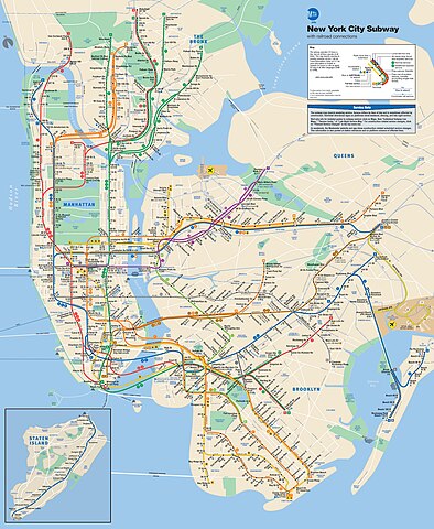
| Paglalarawan | This is the official map of the New York City Subway as of June 2013 and produced by the Metropolitan Transportation Authority of the State of New York. |
| Petsa | |
| Pinanggalingan |
Official New York City Subway Map
|
| May-akda | Metropolitan Transportation Authority of the State of New York |
Paglilisensiya
Ang talaksang ito ay nakalisensiya sa ilalim ng lisensiyang Atribusyon 2.0 Heneriko ng Creative Commons.
- Malaya kang:
- para ibahagi – para kopyahin, ipamahagi, at i-transmit ang akda
- para i-remix – para i-adapt ang akda
- Sa ilalim ng mga kondisyong ito:
- atribusyon – Dapat magbigay ka ng isang maayos na pag-credit, ibigay ang link sa lisensiya, at tukuyin kung may mga pagbabagong ginawa. Magagawa mo ito sa isang risonableng paraan, pero hindi sa paraan na para bang ineendorso ka o ng paggamit mo ng naglisensiya sa'yo.

|
This work includes material that may be protected as a trademark in some jurisdictions. If you want to use it, you have to ensure that you have the legal right to do so and that you do not infringe any trademark rights. See our general disclaimer. This tag does not indicate the copyright status of the attached work. A normal copyright tag is still required. See Commons:Licensing. |
| This image, originally posted to Flickr, was reviewed on 11 June 2013 by the administrator or reviewer File Upload Bot (Magnus Manske), who confirmed that it was available on Flickr under the stated license on that date. |
Nakaraan ng file
Pindutin ang araw/oras upang makita kung papaano ang itsura ng talaksan noong oras na iyon.
| Araw/Oras | Thumbnail | Mga dimensiyon | tagagamit | Kumento | |
|---|---|---|---|---|---|
| ngayon | 20:56, 27 Nobyembre 2020 | | 1,419 × 1,728 (1.03 MB) | Pi.1415926535 | Reverted to version as of 18:22, 11 June 2013 (UTC) per Commons:Deletion requests/File:Official New York City Subway Map vc.jpg |
| 02:48, 6 Nobyembre 2019 |  | 2,700 × 3,314 (5.34 MB) | Ɱ | One station opened (WTC Cortlandt) | |
| 14:04, 28 Oktubre 2019 |  | 6,003 × 7,258 (9.71 MB) | Ɱ | Did you not read what I wrote? This is not a significant enough derivative to be in copyright. | |
| 07:15, 28 Oktubre 2019 |  | 1,419 × 1,728 (1.03 MB) | Vcohen | Reverted to version as of 21:16, 4 January 2017 (UTC) the license is for the 2013 version | |
| 04:33, 28 Oktubre 2019 |  | 6,003 × 7,258 (9.71 MB) | Ɱ | somehow lost resolution | |
| 04:30, 28 Oktubre 2019 |  | 6,003 × 7,258 (9.71 MB) | Ɱ | Not significant enough expressive changes to qualify as a derivative work of the 2013 copy, only minor alterations. | |
| 21:16, 4 Enero 2017 |  | 1,419 × 1,728 (1.03 MB) | Vcohen | the new version does not match the source and license | |
| 05:10, 2 Enero 2017 |  | 2,001 × 2,419 (1.32 MB) | Cbuccella | Official MTA subway map as of 2017.01.01. Includes Hudson Yards station and Q Line extension. | |
| 18:22, 11 Hunyo 2013 |  | 1,419 × 1,728 (1.03 MB) | File Upload Bot (Magnus Manske) | Transferred from Flickr by User:vcohen using flickr2commons |
Mga ugnay
Nakaturo sa talaksan na ito ang mga sumusunod na mga pahina:
Pandaigdigang paggamit sa file
Ginagamit ng mga sumusunod na wiki ang file na ito:
- Paggamit sa az.wikipedia.org
- Paggamit sa be.wikipedia.org
- Paggamit sa de.wikipedia.org
- Paggamit sa en.wikipedia.org
- Paggamit sa he.wikipedia.org
- Paggamit sa hr.wikipedia.org
- Paggamit sa id.wikipedia.org
- Paggamit sa it.wikipedia.org
- Paggamit sa ja.wikipedia.org
- Paggamit sa ko.wikipedia.org
- Paggamit sa ru.wikipedia.org
- Paggamit sa tr.wikipedia.org
- Paggamit sa uk.wikipedia.org
- Paggamit sa www.wikidata.org
- Paggamit sa zh.wikipedia.org