Talaksan:TheCoffeePot.jpg
Buong resolusyon ((2,862 × 1,890 pixel, laki ng talaksan: 3.84 MB, uri ng MIME: image/jpeg))
|
|
Ito ay isang talaksan mula sa Wikimedia Commons. Makikita sa ibaba ang impormasyon mula sa pahina ng paglalarawan nito roon. |
Buod
|
This is an image of a place or building that is listed on the National Register of Historic Places in the United States of America. Its reference number is 5000097. |
| Paglalarawan |
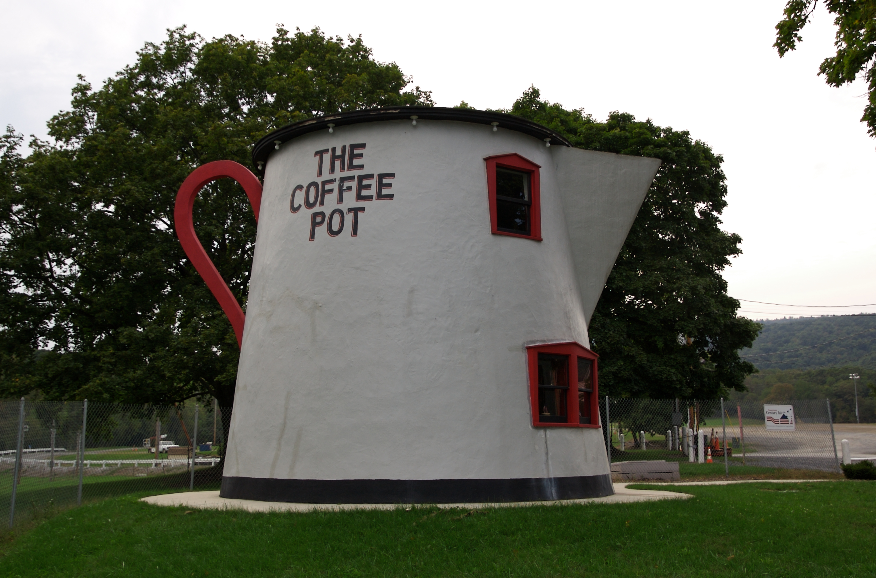
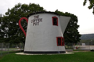
From the exhibit sign: The increased number of automobiles during the Lincoln Highway era (1912-1940) led to the development of programmatic architecture. Proprietors took daring approaches to appeal to the new motoring public. All across the country, over-sized buildings were being created in the likeness of objects. Some of the more famous were constructed in Pennsylvania along the Lincoln Highway route -- the Coffee Pot, the Ship Hotel, the Shoe House, etc. Many have fallen into disrepair. In 1927, Bert Koontz designed and quickly erected the Coffee Pot on the wend end of Bedford. His intention was to attract visitors to his adjacent gas station. The early restaurant served ice cream, hamburgers and Coca=Cola. In 1937 it was converted to a bar and a hotel was built in the rear. The Coffee Pot became a regular stop for Greyhound bus passengers since the bus depot was next door. In an effort to save the Coffee Pot, the Lincoln Highway Heritage Corridor moved it to this location and restored it in 2004. |
| Petsa | Kinuha noong 20 Setyembre 2008, 14:46 |
| Pinanggalingan | The Coffee Pot (Bedford, Pennsylvania) |
| May-akda | Jeff Kubina from Columbia, Maryland |
| Camera location | | View this and other nearby images on: OpenStreetMap |
|---|
Paglilisensiya
- Malaya kang:
- para ibahagi – para kopyahin, ipamahagi, at i-transmit ang akda
- para i-remix – para i-adapt ang akda
- Sa ilalim ng mga kondisyong ito:
- atribusyon – Dapat magbigay ka ng isang maayos na pag-credit, ibigay ang link sa lisensiya, at tukuyin kung may mga pagbabagong ginawa. Magagawa mo ito sa isang risonableng paraan, pero hindi sa paraan na para bang ineendorso ka o ng paggamit mo ng naglisensiya sa'yo.
- share alike – Kung ire-remix mo, babaguhin, o magdadagdag ka sa materyal, dapat mong ipamahagi ang mga ambag mo sa ilalim ng pareho o katulad na lisensiya.
| This image, originally posted to Flickr, was reviewed on October 6, 2008 by the administrator or reviewer File Upload Bot (Magnus Manske), who confirmed that it was available on Flickr under the stated license on that date. |
Nakaraan ng file
Pindutin ang araw/oras upang makita kung papaano ang itsura ng talaksan noong oras na iyon.
| Araw/Oras | Thumbnail | Mga dimensiyon | tagagamit | Kumento | |
|---|---|---|---|---|---|
| ngayon | 02:04, 6 Oktubre 2008 | | 2,862 × 1,890 (3.84 MB) | File Upload Bot (Magnus Manske) | {{Information |Description= From the exhibit sign: The increased number of automobiles during the Lincoln Highway era (1912-1940) led to the development of programmatic architecture. Proprietors took daring approaches to appeal to the new motoring public |
Mga ugnay
Nakaturo sa talaksan na ito ang mga sumusunod na mga pahina:
Pandaigdigang paggamit sa file
Ginagamit ng mga sumusunod na wiki ang file na ito:
- Paggamit sa de.wikivoyage.org
- Paggamit sa en.wikipedia.org
- Paggamit sa no.wikipedia.org
- Paggamit sa sv.wikipedia.org
- Paggamit sa www.wikidata.org