Talaksan:US Navy 110320-N-OB360-166 An aerial view of ships washed ashore and overturned at a port near the Japan Air Self-Defense Force Matsushima Air Base.jpg
Buong resolusyon ((2,500 × 1,660 pixel, laki ng talaksan: 835 KB, uri ng MIME: image/jpeg))
|
|
Ito ay isang talaksan mula sa Wikimedia Commons. Makikita sa ibaba ang impormasyon mula sa pahina ng paglalarawan nito roon. |
Buod
| Paglalarawan |
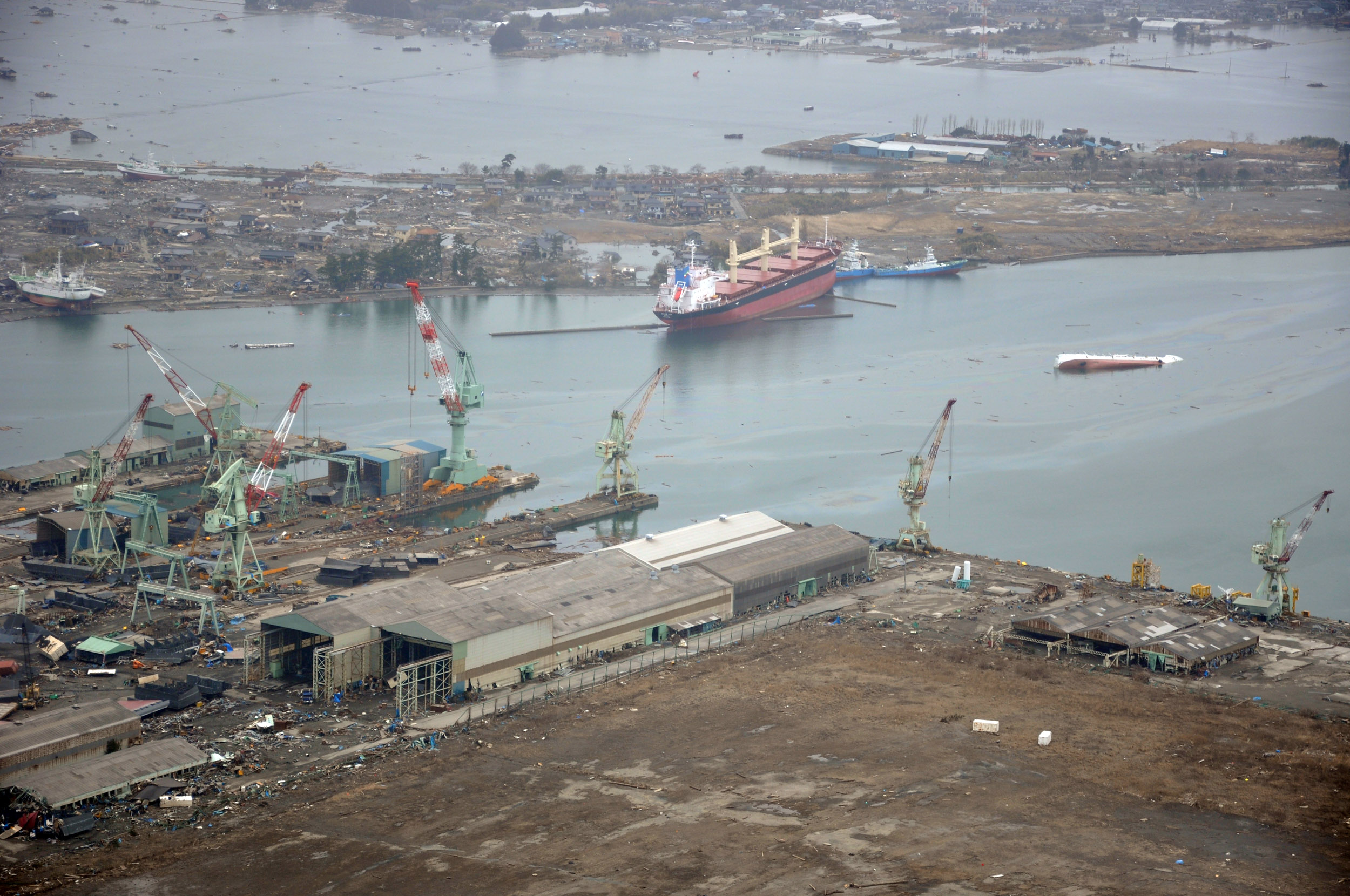
English: NORTHERN JAPAN (March 20, 2011) An aerial view of ships washed ashore and overturned at the port of Ishinomaki near the Japan Air Self-Defense Force Matsushima Air Base. The air base is serving as a refueling station for CH-46 Sea Knight helicopters assigned to Marine Medium Helicopter Squadron (HMM) 265 as they conduct humanitarian assistance missions in Northern Japan as part of Operation Tomodachi. (U.S. navy photo by Mass Communication Specialist 1st Class Ben Farone/Released)
|
|||
| Petsa | Kinuha noong 20 Marso 2011 | |||
| Pinanggalingan |
|
|||
| May-akda | U.S. navy photo by Mass Communication Specialist 1st Class Ben Farone |

| Camera location | | View this and other nearby images on: OpenStreetMap |
|---|
Paglilisensiya
This file is a work of a sailor or employee of the U.S. Navy, taken or made as part of that person's official duties. As a work of the U.S. federal government, it is in the public domain in the United States.
|
 | |
| Nakilala ang talaksan bilang malaya mula sa nalalamang mga paghahangga sa ilalim ng batas sa karapatang-ari, kasama ang lahat ng mga kaugnay at karatig na mga karapatan. | ||
Nakaraan ng file
Pindutin ang araw/oras upang makita kung papaano ang itsura ng talaksan noong oras na iyon.
| Araw/Oras | Thumbnail | Mga dimensiyon | tagagamit | Kumento | |
|---|---|---|---|---|---|
| ngayon | 02:14, 22 Marso 2011 | | 2,500 × 1,660 (835 KB) | BotMultichillT | == {{int:filedesc}} == {{Information |description={{en|1=NORTHERN JAPAN (March 20, 2011) An aerial view of ships washed ashore and overturned at a port near the Japan Air Self-Defense Force Matsushima Air Base. The air base is serving as a refueling stat |
Mga ugnay
Nakaturo sa talaksan na ito ang mga sumusunod na mga pahina:
Pandaigdigang paggamit sa file
Ginagamit ng mga sumusunod na wiki ang file na ito:
- Paggamit sa de.wikipedia.org
- Paggamit sa en.wikipedia.org
- Paggamit sa fr.wikipedia.org
- Paggamit sa ja.wikipedia.org
- Paggamit sa ko.wikipedia.org
- Paggamit sa ms.wikipedia.org
- Paggamit sa nl.wikipedia.org
- Paggamit sa tr.wikipedia.org
- Paggamit sa zh.wikipedia.org