Talaksan:Caucasus central asia political map 2000.jpg

Laki ng pasilip na ito: 800 x 596 na pixel. Ibang resolusyon: 320 x 239 na pixel | 640 x 477 na pixel | 1,024 x 763 na pixel | 1,280 x 954 na pixel | 1,390 x 1,036 na pixel.
Buong resolusyon ((1,390 × 1,036 pixel, laki ng talaksan: 164 KB, uri ng MIME: image/jpeg))
|
|
Ito ay isang talaksan mula sa Wikimedia Commons. Makikita sa ibaba ang impormasyon mula sa pahina ng paglalarawan nito roon. |
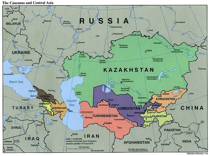
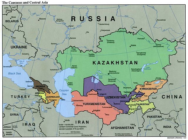
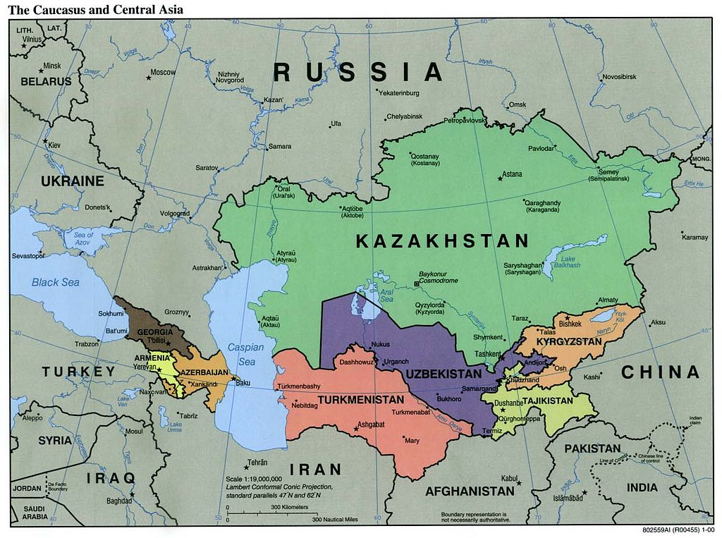
| Paglalarawan | Political Map of the Caucasus and Central Asia | ||||||
| Pinanggalingan | http://ftp.lib.utexas.edu/maps/kazakhstan.html (CIA-Scans) | ||||||
| May-akda | CIA | ||||||
| Permiso (Muling paggamit sa file) |
|
||||||
| Iba pang mga bersyon | Derivative works of this file: Central Asia - political map.svg | ||||||

Nakaraan ng file
Pindutin ang araw/oras upang makita kung papaano ang itsura ng talaksan noong oras na iyon.
| Araw/Oras | Thumbnail | Mga dimensiyon | tagagamit | Kumento | |
|---|---|---|---|---|---|
| ngayon | 01:20, 9 Nobyembre 2004 | | 1,390 × 1,036 (164 KB) | Annalog~commonswiki | The Caucasus and Central Asia Political Map 2000 |
Mga ugnay
Nakaturo sa talaksan na ito ang mga sumusunod na mga pahina:
Pandaigdigang paggamit sa file
Ginagamit ng mga sumusunod na wiki ang file na ito:
- Paggamit sa en.wikipedia.org
- Paggamit sa es.wikipedia.org
- Paggamit sa id.wikipedia.org
- Paggamit sa jv.wikipedia.org
- Paggamit sa min.wikipedia.org
- Paggamit sa ml.wikipedia.org
- Paggamit sa ro.wikipedia.org
- Paggamit sa te.wikipedia.org
- Paggamit sa th.wikipedia.org
- Paggamit sa zh-min-nan.wikipedia.org