Talaksan:Continental-Europe-map.png
Walang resolusyong mataas.
Continental-Europe-map.png ((415 × 422 pixel, laki ng talaksan: 12 KB, uri ng MIME: image/png))
|
|
Ito ay isang talaksan mula sa Wikimedia Commons. Makikita sa ibaba ang impormasyon mula sa pahina ng paglalarawan nito roon. |
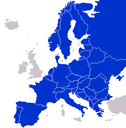
A map of Continental Europe.
| Ako, ang may tangan ng karapatang-ari ng akdang ito, ay pinakakawalan ang akdang ito sa nasasakupan ng madla. Magagamit ito sa buong mundo. Maaaring hindi ito posibleng legal sa ilang mga bansa; kung ganito: Ibinibigay ko sa sinuman ang karapatang gamitin ang akdang ito para sa anumang layunin, na walang mga kundisyon, maliban na lang kung ang ganyang mga kundisyon ay kailangan ng batas. |
derivative works
Derivative works of this file: Kontinentet.png

|
This locator map image could be re-created using vector graphics as an SVG file. This has several advantages; see Commons:Media for cleanup for more information. If an SVG form of this image is available, please upload it and afterwards replace this template with
{{vector version available|new image name}}.
It is recommended to name the SVG file “Continental-Europe-map.svg”—then the template Vector version available (or Vva) does not need the new image name parameter. |
Nakaraan ng file
Pindutin ang araw/oras upang makita kung papaano ang itsura ng talaksan noong oras na iyon.
| Araw/Oras | Thumbnail | Mga dimensiyon | tagagamit | Kumento | |
|---|---|---|---|---|---|
| ngayon | 01:47, 8 Setyembre 2023 | | 415 × 422 (12 KB) | Sariyr | Exit Vendsyssel-Thy (Denmark) |
| 08:06, 18 Hulyo 2009 |  | 415 × 422 (14 KB) | Hoshie | redid Kosovo/Montenegro borders based on Cradel's older map; anti-alasing has been removed. | |
| 10:18, 27 Setyembre 2008 |  | 415 × 422 (14 KB) | Hoshie | readded Kosovo in a different way. See talk. | |
| 03:18, 25 Setyembre 2008 |  | 415 × 422 (14 KB) | Hoshie | added Montenegro and fix the tripoint between Albania, Serbia/Kosovo and Montenegro | |
| 15:40, 16 Setyembre 2008 |  | 415 × 422 (10 KB) | Tocino | Reverted to version as of 00:00, 16 September 2008 | |
| 10:06, 16 Setyembre 2008 |  | 415 × 422 (10 KB) | Cradel | Reverted to version as of 20:45, 15 September 2008 | |
| 00:00, 16 Setyembre 2008 |  | 415 × 422 (10 KB) | Tocino | Reverted to version as of 17:25, 15 September 2008 | |
| 20:45, 15 Setyembre 2008 |  | 415 × 422 (10 KB) | Cradel | Reverted to version as of 11:56, 14 September 2008 | |
| 17:25, 15 Setyembre 2008 |  | 415 × 422 (10 KB) | Tocino | Reverted to version as of 14:24, 12 January 2008 | |
| 11:56, 14 Setyembre 2008 |  | 415 × 422 (10 KB) | Cradel | fix |
Mga ugnay
Walang mga pahina ang tumuturo sa talaksang ito.
Pandaigdigang paggamit sa file
Ginagamit ng mga sumusunod na wiki ang file na ito:
- Paggamit sa ar.wikipedia.org
- Paggamit sa az.wikipedia.org
- Paggamit sa bs.wikipedia.org
- Paggamit sa ca.wikipedia.org
- Paggamit sa ckb.wikipedia.org
- Paggamit sa da.wikipedia.org
- Paggamit sa de.wikipedia.org
- Paggamit sa en.wikipedia.org
- Paggamit sa eo.wikipedia.org
- Paggamit sa es.wikipedia.org
- Paggamit sa eu.wikipedia.org
- Paggamit sa fa.wikipedia.org
- Paggamit sa fi.wikipedia.org
- Paggamit sa fo.wikipedia.org
- Paggamit sa gl.wikipedia.org
- Paggamit sa hy.wikipedia.org
- Paggamit sa id.wikipedia.org
- Paggamit sa is.wikipedia.org
- Paggamit sa it.wikipedia.org
- Paggamit sa ja.wikipedia.org
- Paggamit sa kk.wikipedia.org
- Paggamit sa ko.wikipedia.org
- Paggamit sa nl.wikipedia.org
- Paggamit sa nn.wikipedia.org
- Paggamit sa pl.wikipedia.org
- Paggamit sa pt.wikipedia.org
- Paggamit sa ro.wikipedia.org
- Paggamit sa ru.wikipedia.org
- Paggamit sa sco.wikipedia.org
- Paggamit sa sv.wikipedia.org
- Paggamit sa th.wikipedia.org
- Paggamit sa tr.wikipedia.org
- Paggamit sa uk.wikipedia.org
- Paggamit sa www.wikidata.org