Talaksan:Kirogi 2017-11-18 0300Z.jpg

Laki ng pasilip na ito: 457 x 600 na pixel. Ibang mga resolusyon: 183 x 240 na pixel | 366 x 480 na pixel | 585 x 768 na pixel | 780 x 1,024 na pixel | 1,560 x 2,048 na pixel | 6,400 x 8,400 na pixel.
Buong resolusyon ((6,400 × 8,400 pixel, laki ng talaksan: 8.2 MB, uri ng MIME: image/jpeg))
|
|
Ito ay isang talaksan mula sa Wikimedia Commons. Makikita sa ibaba ang impormasyon mula sa pahina ng paglalarawan nito roon. |
Buod
| Paglalarawan |
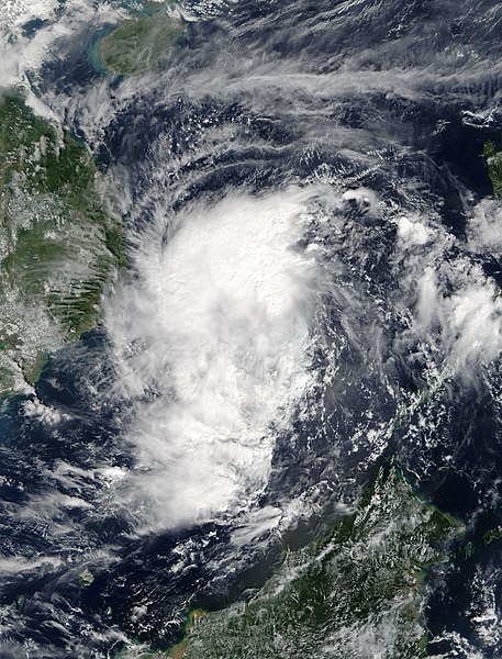
English: Tropical Storm Kirogi (31W) approaching Indochina |
| Petsa | |
| Pinanggalingan | https://lance-modis.eosdis.nasa.gov/cgi-bin/imagery/single.cgi?image=Kirogi.A2017322.0300.250m.jpg |
| May-akda | National Aeronautics and Space Administration, LANCE/EOSDIS Rapid Response, captured on Terra satellite |
| Metadata | https://lance.modaps.eosdis.nasa.gov/cgi-bin/imagery/single.cgi?metadata=Kirogi.A2017322.0300.txt |
| Satellite | Terra |
| Camera location | | View this and other nearby images on: OpenStreetMap |
|---|
Paglilisensiya
| This file is in the public domain in the United States because it was solely created by NASA. NASA copyright policy states that "NASA material is not protected by copyright unless noted". (See Template:PD-USGov, NASA copyright policy page or JPL Image Use Policy.) | ||
 |
Warnings:
|
Nakaraan ng file
Pindutin ang araw/oras upang makita kung papaano ang itsura ng talaksan noong oras na iyon.
| Araw/Oras | Thumbnail | Mga dimensiyon | tagagamit | Kumento | |
|---|---|---|---|---|---|
| ngayon | 19:56, 18 Nobyembre 2017 | | 6,400 × 8,400 (8.2 MB) | Typhoon2013 | 250m res |
| 07:26, 18 Nobyembre 2017 |  | 5,937 × 7,841 (6.1 MB) | Typhoon2013 | User created page with UploadWizard |
Mga ugnay
Nakaturo sa talaksan na ito ang mga sumusunod na mga pahina:
Pandaigdigang paggamit sa file
Ginagamit ng mga sumusunod na wiki ang file na ito:
- Paggamit sa en.wikipedia.org
- Paggamit sa ja.wikipedia.org
- Paggamit sa ko.wikipedia.org
- Paggamit sa pt.wikipedia.org
- Paggamit sa ru.wikipedia.org
- Paggamit sa th.wikipedia.org
- Paggamit sa zh.wikipedia.org