Talaksan:Kudaka Island,Nanjo.jpg

Laki ng pasilip na ito: 800 x 392 na pixel. Ibang mga resolusyon: 320 x 157 na pixel | 640 x 314 na pixel | 1,024 x 502 na pixel | 1,280 x 628 na pixel | 2,560 x 1,256 na pixel | 5,300 x 2,600 na pixel.
Buong resolusyon ((5,300 × 2,600 pixel, laki ng talaksan: 4.07 MB, uri ng MIME: image/jpeg))
|
|
Ito ay isang talaksan mula sa Wikimedia Commons. Makikita sa ibaba ang impormasyon mula sa pahina ng paglalarawan nito roon. |
Buod
| Paglalarawan |
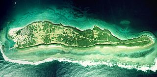
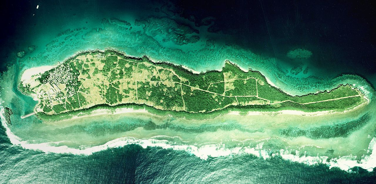
English: Kudaka Island, Nanjo, Okinawa, Japan.
日本語: 久高島(沖縄県南城市)
国土交通省の国土画像情報(カラー空中写真)を元に作成。
|
| Petsa | |
| Pinanggalingan | COK-77-1-C87-6, COK-77-1-C87-7, COK-77-1-C87-8 |
| May-akda |
English: Geospatial Information Authority of Japan
日本語: 国土地理院 |
| Camera location | | View this and other nearby images on: OpenStreetMap |
|---|
| This is a retouched picture, which means that it has been digitally altered from its original version. Modifications: Combined 3 aerial photos and cropped. Modifications made by Kugel~commonswiki.
|
Paglilisensiya

|
Nagpapahintulot sa sinuman ang may-hawak ng karapatang-ari sa talaksang ito, the Ministry of Land, Infrastructure, Transport and Tourism of Japan, na gamitin ito para sa anumang layunin, basta't angkop na binabanggit ang tagahawak ng karapatang-ari. Pinapayagan ang muling pagpapamahagi, gawaing hango, pangkomersiyong paggamit, at lahat ng iba pang paggamit. |
Atribusyon:
Copyright © National Land Image Information (Color Aerial Photographs), Ministry of Land, Infrastructure, Transport and Tourism
|
 |
This image is copyrighted by the Ministry of Land, Infrastructure, Transport and Tourism of Japan. For terms of use, see the stipulation to use of National Land Information (in Japanese) and message from MLIT (in Japanese and English). When you display this image on an article, include the following phrase in the description: "Made based on National Land Image Information (Color Aerial Photographs), Ministry of Land, Infrastructure, Transport and Tourism".
|
Nakaraan ng file
Pindutin ang araw/oras upang makita kung papaano ang itsura ng talaksan noong oras na iyon.
| Araw/Oras | Thumbnail | Mga dimensiyon | tagagamit | Kumento | |
|---|---|---|---|---|---|
| ngayon | 06:27, 20 Marso 2017 | | 5,300 × 2,600 (4.07 MB) | Kugel~commonswiki | Combined photos using by stitching software |
| 08:44, 17 Oktubre 2013 | 5,529 × 1,185 (2.36 MB) | Kugel~commonswiki | renewal | ||
| 10:50, 31 Marso 2010 |  | 5,425 × 2,921 (1.88 MB) | Kugel~commonswiki | {{Information |Description={{en|1=Kudaka Island, Nanjo, Okinawa, Japan.}} {{ja|1=久高島(沖縄県南城市)}} |Source=Japanese Ministry of Land, Infrastructure, Transport and Tourism[http://w3land.mlit.go.jp/cgi-bin/WebGIS2/WC_AirPhoto.cgi?IT=p&DT= |
Mga ugnay
Walang mga pahina ang tumuturo sa talaksang ito.
Pandaigdigang paggamit sa file
Ginagamit ng mga sumusunod na wiki ang file na ito:
- Paggamit sa cs.wikipedia.org
- Paggamit sa ja.wikipedia.org
- Paggamit sa zh.wikipedia.org